


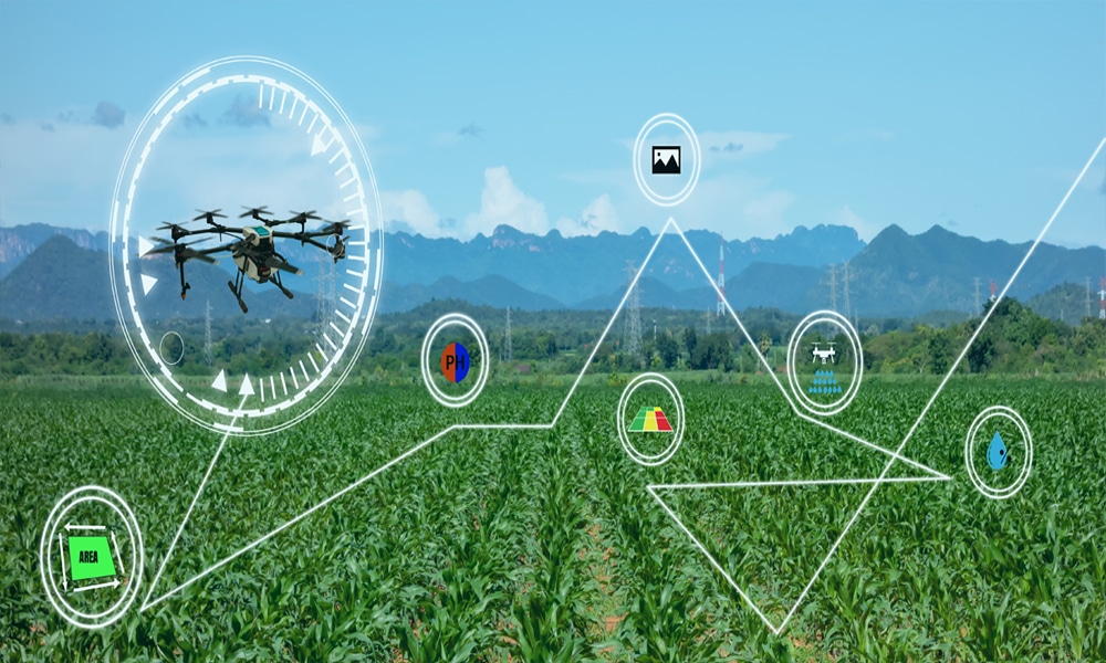
In today’s competitive agricultural landscape, the ability to make data-driven decisions is more critical than ever. Our drone agriculture services provide farmers with the insights they need to optimize crop management, increase efficiency, and enhance overall productivity. By integrating technology into traditional farming practices, we enable farmers to harness the full potential of their land.
Our company, Amped Aerial, leverages advanced drone technology to enhance agricultural productivity. Our drones, equipped with high-resolution cameras and various sensors, collect critical data on crop health and soil conditions. This data is essential for farmers who want to increase their yields and improve their overall farming practices. For instance, by tracking crop health over the growing season, farmers can see how their crops respond to different weather conditions and management practices, helping them make informed decisions.
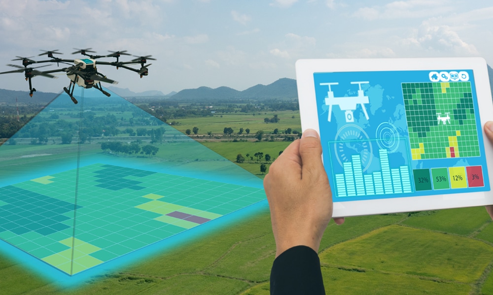
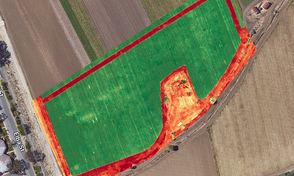
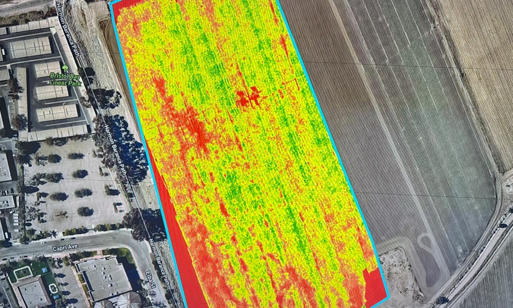
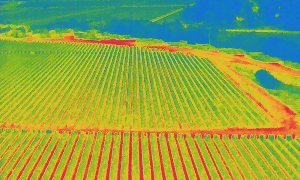
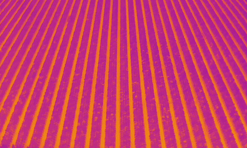
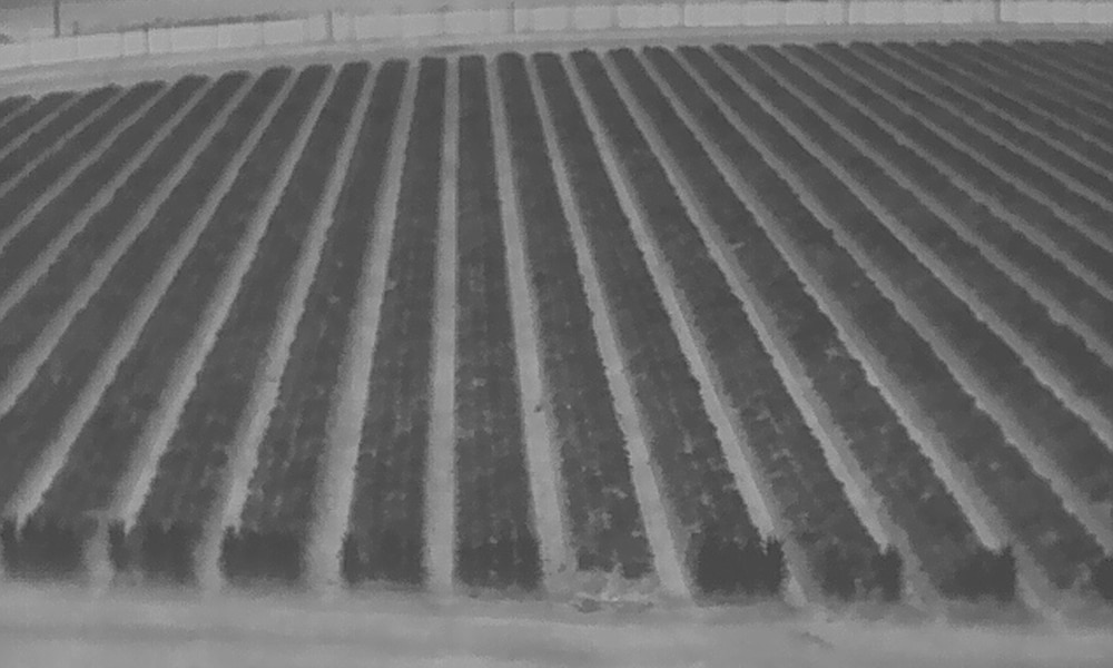
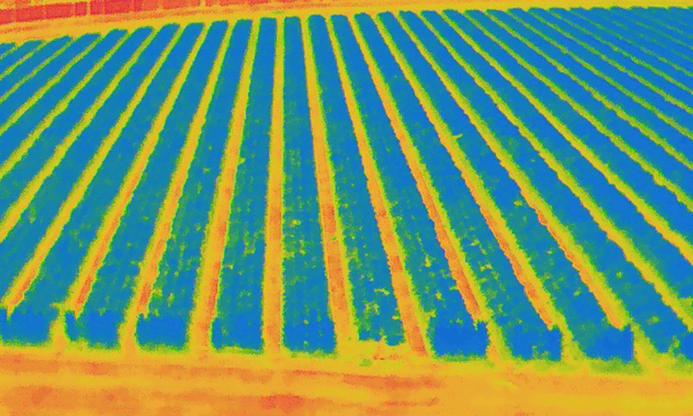
We use this information to generate detailed field maps and real-time analytics, aiding farmers in making key decisions for irrigation and fertilization, thereby optimizing crop yield. Our services include RGB, Thermal IR, and NDVI imaging for comprehensive, season-long insights. These imaging techniques allow us to monitor changes and detect issues in the field before they become significant problems, ensuring that interventions can happen proactively rather than reactively.
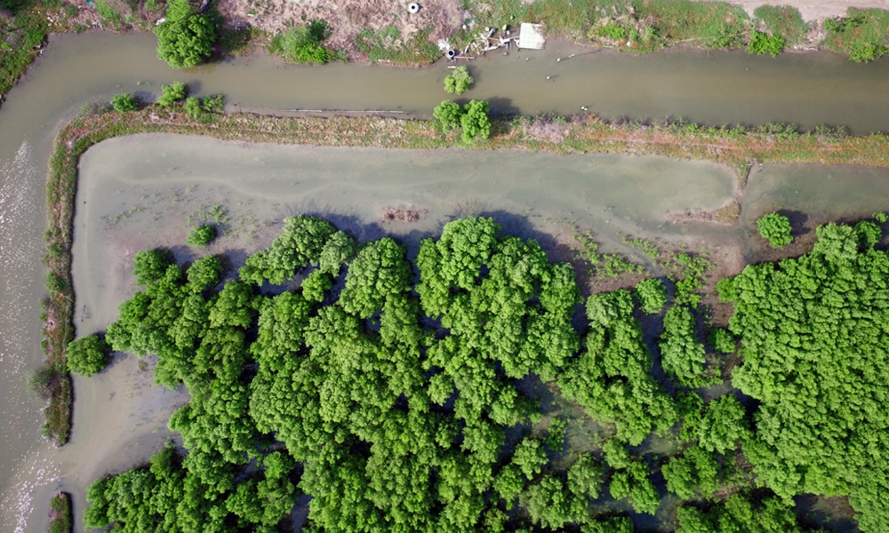
Drones equipped with high-resolution cameras and sensors can quickly survey fields and identify areas that may require attention, such as pests, weeds, or diseases.
Drones can create detailed maps of fields, providing farmers with accurate information about soil conditions, crop health, and other important factors that can impact crop yield.
Drones can be used to apply fertilizers and other chemicals to crops in a precise manner, reducing the amount of chemicals needed and minimizing the risk of overspray.
Drones can be used to monitor soil moisture levels and identify areas that may need additional irrigation, helping farmers optimize their water usage.
Drones can be used to plant seeds in a precise and efficient manner, reducing the need for manual labor and improving crop establishment.
Drones can be used to monitor livestock and identify any potential issues, such as illness or injury.
In the event of a natural disaster, drones can be used to assess damage and identify areas that may need assistance.
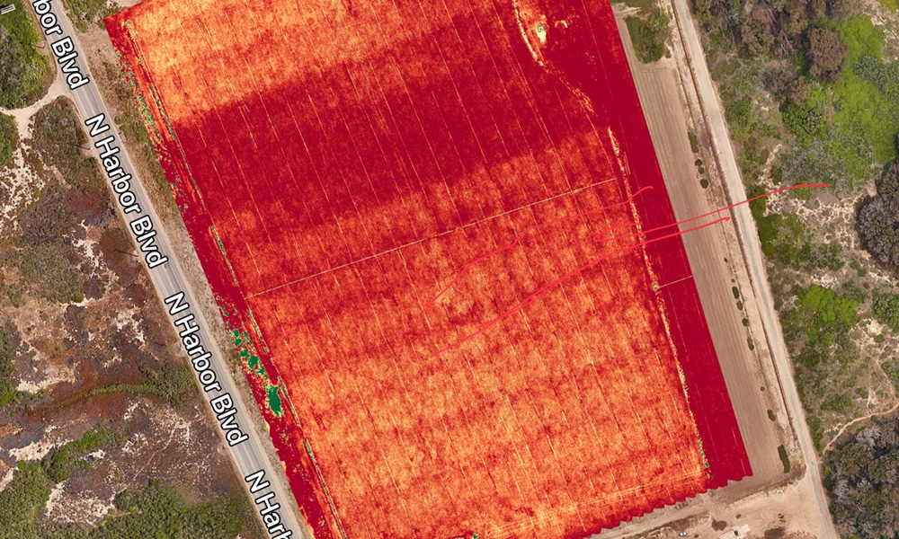
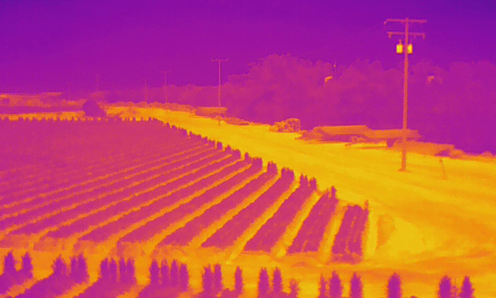
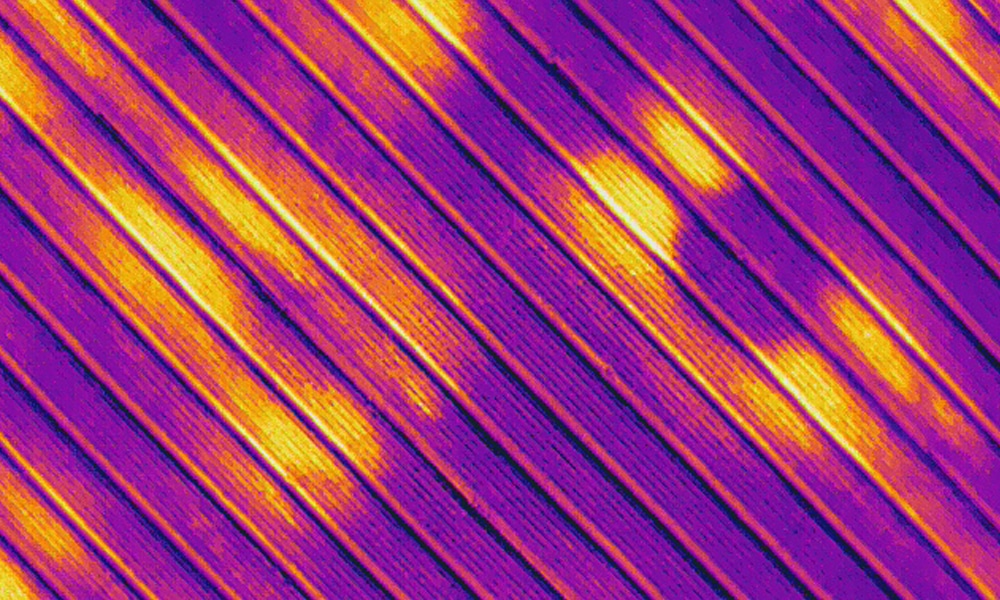
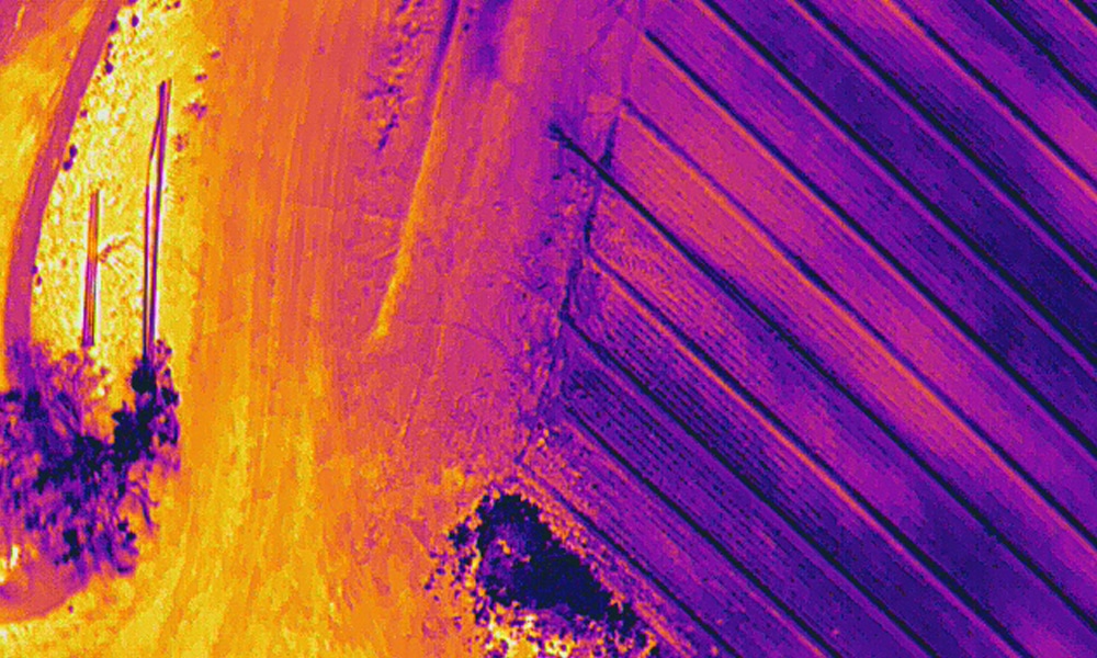
The use of drones and infrared sensors has led Amped Aerial to offer high-quality radiometric imagery to many industries. Identifying anomalies in temperature variations can help identify problems early, saving your business time and money. For example, thermal imaging can detect plant stress before it is visible to the naked eye, allowing farmers to address issues before they affect yield. We offer high-quality processed radiometric imagery and maps that can guide decisions in real-time.
Uses of drones in agriculture include monitoring irrigation efficiency, assessing heat stress in crops, and evaluating the effectiveness of pest control measures.
Additionally, the integration of drone technology in agriculture promotes sustainable farming practices. By utilizing precision agriculture techniques, farmers can reduce the amount of chemicals applied to their fields, leading to healthier crops and a lessened environmental impact. Drones also enable farmers to be more efficient with their resources, ensuring that every drop of water and every ounce of fertilizer is used effectively.
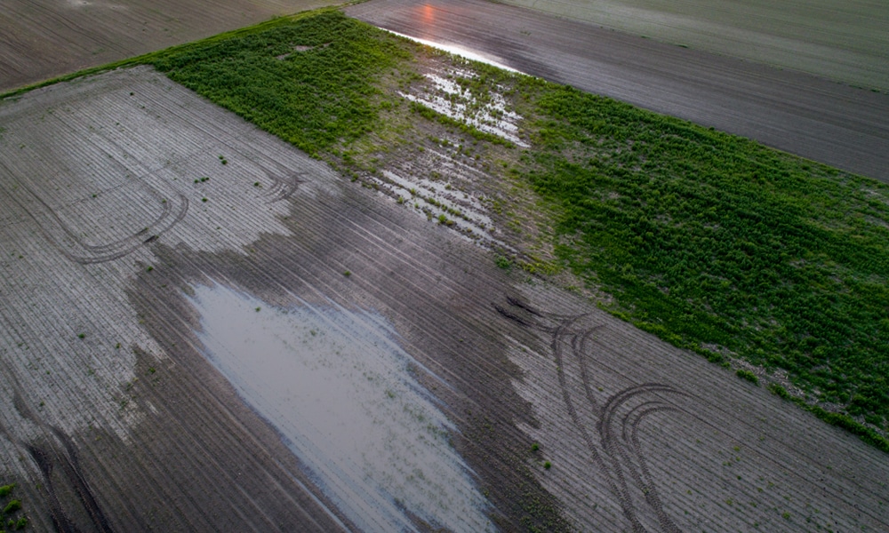
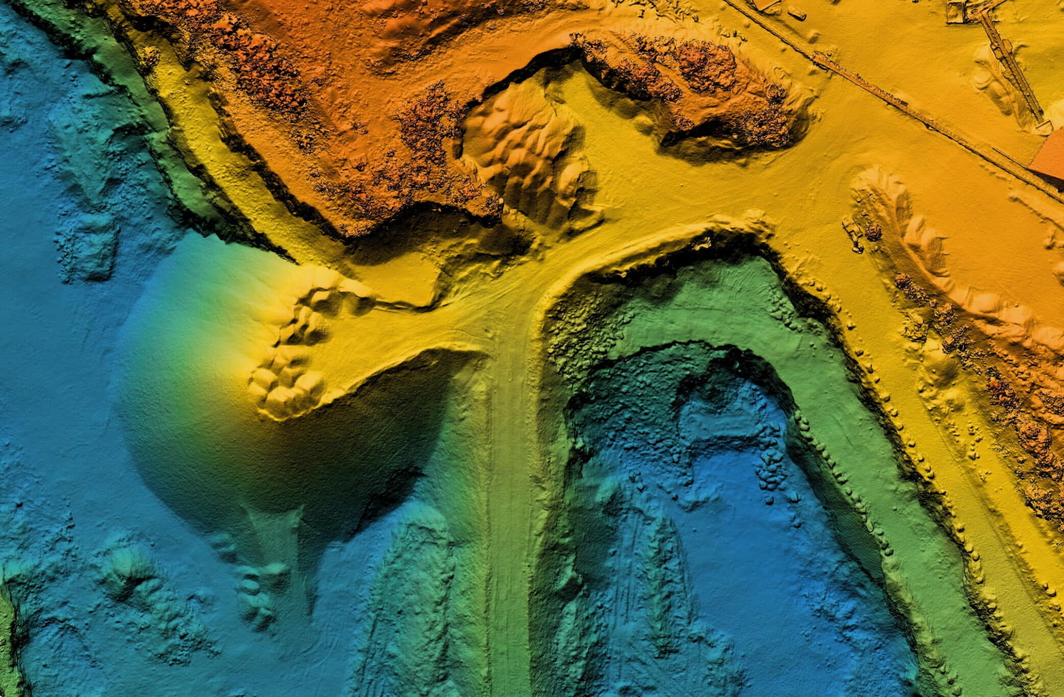
Water conservation is increasingly vital in modern agriculture. Using drone maps, digital surface models, and terrain models for irrigation and drainage management is essential to optimizing water use. Drones can capture multispectral data and thermal imaging, which can help identify irrigation leaks or areas that require more water. For example, by pinpointing where water is being lost or underutilized, farmers can adjust their irrigation practices to conserve resources and improve crop outcomes.
With Amped Aerial, you can implement advanced water management solutions that not only enhance the efficiency of your irrigation systems but also contribute to sustainable farming practices.
Using drone maps, digital surface models, and terrain models for irrigation and drainage management. Multispectral data and Thermal imaging can also help identify irrigation leaks or areas that need more water. Water conservation is more important now than ever and Amped Aerial can help provide your business with water saving solutions.
Furthermore, drone agriculture services can play a significant role in soil health monitoring. By conducting regular aerial surveys, farmers can assess soil moisture levels and nutrient content across different areas of their fields. This data is crucial for making informed decisions about crop rotation and soil amendments, ultimately leading to healthier soil and more productive crops.